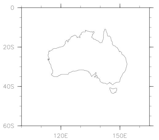
Just a note to myself on plotting data over Australia using NCL with only the coastal lines for Australia shown, using the low-res map:
; Plot data only over Australia (including Tasmania) using the default
; low-res database. Based on maponly_8.ncl from the NCL website.
;
; Carlo Hamalainen 2012-06-13

load "$NCARG_ROOT/lib/ncarg/nclscripts/csm/gsn_code.ncl"
load "$NCARG_ROOT/lib/ncarg/nclscripts/csm/gsn_csm.ncl"

begin

  wks  = gsn_open_wks("png","maponly")

  res                           = True
  res@mpOutlineOn               = True
  res@mpFillOn                  = False

  res@mpOutlineBoundarySets     = "NoBoundaries"
  res@mpDataBaseVersion         = "LowRes"

  res@mpMinLatF = -60
  res@mpMaxLatF = 0
  res@mpMinLonF = 100
  res@mpMaxLonF = 165

  res@mpOutlineSpecifiers = (/"Australia", "Australia-Tasmania"/)
  plot = gsn_csm_map_ce(wks,res)
end
Output: